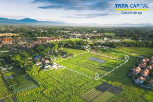
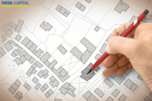
ગોવા, તેના અદભૂત દરિયાકિનારાઓ અને વાઇબ્રન્ટ સંસ્કૃતિ માટે જાણીતું છે, તે રિયલ એસ્ટેટ પ્રવૃત્તિઓ માટે પણ એક હબ છે. તમે સ્થાનિક નિવાસી છો, બિઝનેસના માલિક છો અથવા ગોવામાં પ્રોપર્ટીમાં રોકાણ કરવા માંગો છો, ગોવા લેન્ડ રેકોર્ડ્સની જટિલતાઓને સમજવી મહત્વપૂર્ણ છે. આ લેખ ગોવા લેન્ડ સર્વેક્ષણની વિગતો, ગોવા લેન્ડ મેપ ઇનસાઇટ્સ અને ગોવામાં જમીનના મ્યુટેશન જેવી પ્રક્રિયાઓ સહિત ગોવા લેન્ડ રેકોર્ડ્સ વિશે તમારે જાણવાની જરૂર છે તે બધું માટે વ્યાપક માર્ગદર્શિકા પ્રદાન કરે છે.
ગોવામાં, અન્ય કોઈપણ પ્રદેશની જેમ, જમીનના રેકોર્ડ પ્રોપર્ટી મેનેજમેન્ટ અને કાનૂની ટ્રાન્ઝૅક્શનનો મહત્વપૂર્ણ ભાગ છે. આ રેકોર્ડ્સ માત્ર ડૉક્યૂમેન્ટ જ નથી પરંતુ જમીનની માલિકી સંબંધિત ઇતિહાસ અને કાનૂનીતાનો ભંડાર છે. ચાલો આ રેકોર્ડ્સ અને તેમના મહત્વને સમજવા માટે ઊંડાણપૂર્વક જાણીએ.
ગોવા જમીન રેકોર્ડનું મહત્વ
ગોવા જમીનના રેકોર્ડ્સ એ અધિકૃત ડૉક્યૂમેન્ટ છે જે જમીનની માલિકી વિશે વ્યાપક માહિતી પ્રદાન કરે છે, જેમાં જમીનના માલિક, જમીનના ટ્રાન્ઝૅક્શનનો ઇતિહાસ અને જમીનની વિશિષ્ટ લાક્ષણિકતાઓ વિશેની વિગતો શામેલ છે. તેઓ ઘણા હેતુઓ માટે સેવા આપે છે
Legal Documentation: These records are legally recognized documents that serve as proof of ownership. They are crucial in legal matters like disputes over land ownership, inheritance issues, and court proceedings related to land
Property Transactions: For buying or selling land in Goa, land records are indispensable. They provide transparency and authenticity to the transaction, ensuring that all parties have access to the accurate history and legal status of the property
Agricultural and Developmental Planning: For government authorities and planners, land records are a vital tool in developmental planning, agricultural sector management, zoning, and urban development.
How to Search Goa Land Records Online
ગોવા જમીનના રેકોર્ડ તપાસવા માટે આ પગલાંઓને અનુસરો:
Step 1: Visit the DSLR Goa website.
Step 2: Click on Form I & Form XIV.
Step 3: Select your Taluka, Village, Survey Number, and Subdivision Number from the drop-down menu.
Step 4: Enter the captcha code shown in the image.
Step 5: Click on ‘View Details’.
Step 6: You will now see the land record details for the selected area in Goa
ગોવામાં શહેરનું પ્રોપર્ટી કાર્ડ જોવા માટે:
Step 1: Visit the DSLR website by clicking on the link: https://egov.goa.nic.in/dslr.
Step 2: Click on Form D.
Step 3: Select City, PT Sheet Number, and Chalta Number from the drop-down menu.
Step 4: Enter the captcha from the image into the box provided.
Step 5: Click on ‘View Details’.
Step 6: You will be able to check the property card details of the concerned town in Goa.
Mutation Status Check: Rural vs Urban Processes
ગોવામાં શહેરી શહેરના મ્યુટેશન રિપોર્ટ તપાસવાના પગલાં અહીં આપેલ છે:
Step 1: Visit the DSLR website.
Step 2: Click on the link ‘Mutation Status (Urban)’.
Step 3: Enter the mutation number and copy the captcha from the image into the box provided.
Step 4: Click on ‘View Status’. You will be able to check the mutation report.
ગોવામાં જમીનના રેકોર્ડમાં ઘણા ઘટકો શામેલ છે, જે દરેક એક અલગ હેતુની સેવા આપે છે:
ટાઇટલ ડીડ: આ જમીનની માલિકી સાબિત કરતું મુખ્ય ડૉક્યૂમેન્ટ છે. તેમાં માલિક, પ્રોપર્ટીનું સ્થાન, તેના પરિમાણો અને માલિકીના ઇતિહાસ વિશેની વિગતો શામેલ છે.
સર્વેક્ષણ રેકોર્ડ્સ: આ રેકોર્ડ્સમાં સરકારી અધિકારીઓ દ્વારા આયોજિત જમીન સર્વેક્ષણના પરિણામો શામેલ છે. તેમાં જમીનના વિગતવાર નકશા અને વર્ણન, સીમાઓને ચિહ્નિત કરવા અને કોઈપણ ભૌગોલિક સુવિધાઓની નોંધ શામેલ છે.
મ્યુટેશન રેકોર્ડ્સ: આ માલિકીમાં ફેરફારોના રેકોર્ડ છે અને અપડેટ રાખવા માટે જરૂરી છે. જ્યારે પણ કોઈ પ્રોપર્ટી વેચવામાં આવે અથવા ટ્રાન્સફર કરવામાં આવે, ત્યારે માલિકીમાં ફેરફાર દર્શાવવા માટે મ્યુટેશન રેકોર્ડને અપડેટ કરવા આવશ્યક છે.
ટૅક્સ રેકોર્ડ્સ: આ રેકોર્ડ જમીન પર ટૅક્સ ચુકવણીનો પુરાવો છે. સ્પષ્ટ અને વિવાદિત માલિકી જાળવવા માટે જમીન કરની નિયમિત ચુકવણી આવશ્યક છે.
DSLR Goa Services: Document Requests & Fees
ડીએસએલઆર ગોવા વિવિધ સેવાઓ પ્રદાન કરે છે, જેમાં શામેલ છે:
કેડાસ્ટ્રલ રેકોર્ડ્સ અને પ્લાનનું નિરીક્ષણ કરવું
ગામના નકશાની ડિજિટાઇઝ્ડ કૉપી જારી કરવી
પ્રી-લિબરેશન લેન્ડ રેકોર્ડ્સ અને કમ્યુનિડેડ પ્લાન્સનું નિરીક્ષણ કરવું
શહેર સર્વેક્ષણ વિસ્તારોમાં પ્રોપર્ટીના કબજાની પુષ્ટિ કરી રહ્યા છીએ
જમીન રૂપાંતરણ એપ્લિકેશનોનું સંચાલન
Managing partition requests
Conducting re-surveys and boundary demarcations or refixations
ડીએસએલઆર ગોવા સર્વિસ સેન્ટરની સૂચિ
કેન્દ્રનું નામ
સંપર્ક નંબર
સરનામું
પતાવટ અને જમીન રેકોર્ડ્સ નિયામક
2422453
કલેક્ટરેટ બિલ્ડિંગ, પણજી, ગોવા
Inspector of Settlement and Land Records (Panaji)
2235186
કલેક્ટરેટ બિલ્ડિંગ, પણજી, ગોવા
Inspector of Settlement and Land Records (Mapusa)
2254151
માપુસા, બર્દેઝ
Inspector of Settlement and Land Records (Margao)
2701479
મડગાંવ, સાલસેટ
Inspector of Settlement and Land Records (Vasco)
2516101
વાસ્કો, મોરમુગાઓ
મમલતદાર ઑફ કેનેકોના
2643329
ગવર્મેન્ટ ઑફિસ કૉમ્પ્લેક્સ, કેનાકોના
મમલતદાર ઑફ ધરબંદોરા
2614111
મમલતદાર ઑફિસ, ધરબંદોરા
મમલતદાર ઑફ સંકેમ
2604232
ગવર્મેન્ટ ઑફિસ કૉમ્પ્લેક્સ, સંગુમ
મમલતદાર ઑફ ક્યૂપેમ
2662228
ગવર્મેન્ટ ઑફિસ કૉમ્પ્લેક્સ, ક્વિપેમ
મમલતદાર ઑફ મોરમુગાઓ
2513014
ગવર્મેન્ટ ઑફિસ કૉમ્પ્લેક્સ, મોરમુગાઓ
મમલતદાર ઑફ સાલ્સેટ
2722909
ગવર્મેન્ટ ઑફિસ કૉમ્પ્લેક્સ, મડગાંવ
મમલતદાર ઑફ સત્તારી
2374243
ગવર્મેન્ટ ઑફિસ કૉમ્પ્લેક્સ, સત્તારી
મમલતદાર ઑફ પોંડા
2312121
ગવર્મેન્ટ ઑફિસ કૉમ્પ્લેક્સ, પોન્ડા
મમલતદાર ઑફ બિચોલિમ
2363886
ગવર્મેન્ટ ઑફિસ કૉમ્પ્લેક્સ, બિચોલિમ
મમલતદાર ઑફ પરનેમ
2201223
ગવર્મેન્ટ ઑફિસ કૉમ્પ્લેક્સ, પરનેમ
મમલતદાર ઑફ બર્દેઝ
2262210
ગવર્મેન્ટ ઑફિસ કૉમ્પ્લેક્સ, માપુસા
મમલતદાર ઑફ તિસવાડી
2425533
કલેક્ટરેટ બિલ્ડિંગ, પણજી, ગોવા
મહિતી ઘર (મરગાઓ)
ઉપલબ્ધ નથી
કલેક્ટરેટ બિલ્ડિંગની સામે, મડગાંવ
મહિતી ઘર (પનાજી)
ઉપલબ્ધ નથી
કલેક્ટરેટ બિલ્ડિંગની સામે, પણજી
મહિતી ઘર (કદંબા, બસ સ્ટેન્ડ, પણજી)
ઉપલબ્ધ નથી
KTC સ્ટેન્ડ, પણજી
DSLR Goa Service Fees & Payment Methods
Procedures
ફી
રેકોર્ડ્સનું નિરીક્ષણ
₹10 પ્રતિ કલાક
શોધ અને નિરીક્ષણ (જ્યારે તમને પ્રોપર્ટીની વિગતો જાણતા નથી)
₹20 પ્રતિ કલાક
જૂના પ્લાનની પ્રમાણિત કૉપી
Rs. 30 per sub div. (Cost of paper extra)
Certified Xerox copy of a) Registo de Agrimensor b) Alvara/Title
Rs. 60 per page (Cost of paper extra) Rs. 30 per page (Cost of paper extra)
The survey fees for Partition / Re-survey / Demarcation / Re-fixation /Convention
₹ 820 પ્રતિ દિવસ
(a) Issuance of computerized certified copies of entries in records of rights, mutation registers, and other Talathi-maintained documents under Section 8 of the code. (b) Providing digitally signed copies of entries in records of rights, mutation registers, and non-map records maintained by the Mamlatdar.
પ્રથમ પેજ માટે ₹ 15 અને દરેક અતિરિક્ત પેજ માટે ₹ 5. રૂ. 25 પ્રતિ સીરિયલ નંબર અથવા એન્ટ્રી (પેપરનો ખર્ચ બાકાત).
Certified copies of computerized maps or plans of survey numbers or their subdivisions, prepared under Section 56 of the code. Certified copies of Form XV and digitally signed maps or plans incorporating Form I details from the Goa Daman and Diu Land Revenue (Record of Rights and Register of Cultivation) Rules, 1969. Digitally signed maps prepared in Form J, as per the City Survey Rules, 1969.
પેપર સહિત દરેક સર્વે નંબર અથવા સબડિવિઝન માટે ₹60. પેપર સિવાય, સર્વે નંબર અથવા સબડિવિઝન દીઠ ચાર્જ ₹75 થી ₹85 સુધીની હોય છે. કેટલાક કિસ્સાઓ માટે, પેપર ખર્ચ સિવાય, દરેક સર્વે નંબર અથવા સબ-ડિવિઝન દીઠ ફી ₹105 છે.
Certified copies of computerized maps or plans for non-agricultural survey numbers or their subdivisions, as well as digitally signed copies prepared under Section 56 of the code.
પેપર સહિત દરેક સર્વે નંબર અથવા સબડિવિઝન દીઠ ₹60. વૈકલ્પિક રીતે, કાગળ સિવાય, દરેક સર્વે નંબર અથવા સબ-ડિવિઝન દીઠ ખર્ચ ₹75 છે.
વસ્તુઓ (4), (5), અને (6) હેઠળ આવરી લેવામાં ન આવેલ નકશા અથવા પ્લાનની પ્રમાણિત કૉપી અથવા કમ્પ્યુટરાઇઝ્ડ કૉપી.
₹20 થી ₹200 સુધીની રેન્જ. જો કે, કલેક્ટરના રેન્કથી નીચેના અધિકારીઓ સેટલમેન્ટ અને લેન્ડ રેકોર્ડ્સના ડાયરેક્ટરની મંજૂરી વિના ₹50 કરતાં વધુ ચાર્જ વસૂલ કરી શકતા નથી.
વસ્તુઓ (4), (5), અને (6) હેઠળ સૂચિબદ્ધ ન હોય તેવી સંપૂર્ણ વિગતો સાથે રંગીન વર્ઝન સહિત કમ્પ્યુટરાઇઝ્ડ નકશો અથવા પ્લાનની પ્રમાણિત કૉપી.
તમામ વિગતો સાથેની રંગીન કૉપીની કિંમત 10 પી.ટી. શીટ સુધી રૂ. 250 અને પેપરના ખર્ચ સહિત દરેક અતિરિક્ત પી.ટી. શીટ માટે રૂ. 50 છે.
Certified copy of every sheet of paper 30 X 21 Cms in dimension handwritten or typed.
પેપરની દરેક શીટ અથવા તેના ભાગ માટે ₹30.
Goa Land Records by Name: Search & Verification
Land records have often been a source of confusion and dispute. However, many states in India now make these records easily accessible online, including Goa. Goa’s land records search allows individuals to access and verify land records online.
The online Goa land records search allows you to search and sort through land records by name in Goa. This helps confirm ownership, survey numbers, plot boundaries, land use classification, and encumbrance status.
Goa property records verification facilities and DSLR Goa search can help you perform your due diligence before making a property purchase in the state.
When finding land survey records online, you may come across certain common issues. We list some common land record problems below:
1. One of the most common Goa land record issues is incorrect survey numbers. Remember to verify against prior title documents.
2. Ownership discrepancies are also common land record errors in Goa, caused by pending mutations or inheritance transfers. Submitting sale deeds, mutation records, or succession documents helps resolve this.
3. Website glitches are common. Try during off-peak hours, or clear your browser cache; otherwise, records may be accessed offline.
Regular follow-ups and complete documentation are key to handling property dispute solutions in Goa.
Goa Land Records Digital Transformation & Future Trends
Goa land records have been digitised through government efforts to enhance transparency, accessibility, and efficiency. E-governance land records in Goa offer access to Forms I & XIV, mutation status tracking, and cadastral maps, reducing reliance on physical visits.
Future trends include better land record modernisation, integration of GIS mapping, faster online mutation approvals, and improved interlinking between registration and land records databases. DSLR Goa’s digital updates aim to reduce fraud, minimise disputes, and simplify property transactions, making land ownership data more reliable for buyers, lenders, and government authorities alike.
Step-by-Step Mutation Application Process
The Goa land records mutation process is relatively simple. To apply for mutation in Goa, follow the land mutation steps below:
For property transfer mutation, register the land transaction at the Sub-Registrar’s office.
Once the registered deed is issued, apply for Goa’s mutation process at the Tehsil office using Form 21.
Declare details of all land already owned while submitting the mutation application.
The Tehsildar acknowledges the application and records it in the mutation register.
Notices are issued to the relevant parties, and a hearing date is set.
Any objections are formally recorded and acknowledged.
Field verification is conducted, followed by a hearing.
Errors in the land records of Goa’s mutation process are pretty common. Land and survey records (Goa) sometimes involve incorrect survey numbers, mismatched ownership details, or delayed updates.
Rectifying land record errors can be achieved by cross-verifying records against old title documents and filing a rectification request with supporting evidence, such as sale deeds or inheritance certificates. The land record correction process may differ based on whether it’s conducted online or offline.
Correcting online land records in Goa (like portal glitches) may require retrying later or visiting the DSLR office in person. When updating land details in Goa, regular follow-ups help prevent delays caused by verification backlogs.
નિષ્કર્ષ
In summary, comprehending Goa land records, including the land survey, land map, and mutation processes, is crucial for anyone involved in property dealings in Goa. These records provide the necessary clarity and legal backing for property transactions. Additionally, understanding the intricacies of home loans can facilitate a smoother property acquisition process. Remember, a well-informed decision is the key to securing your piece of paradise in Goa.
જમીનના રેકોર્ડને અપડેટ રાખવું શા માટે મહત્વપૂર્ણ છે?
જમીન માલિકો માટે તેમના જમીનના રેકોર્ડ નિયમિતપણે અપડેટ થાય તેની ખાતરી કરવી મહત્વપૂર્ણ છે. માલિકીમાં કોઈપણ ફેરફાર, જમીનના કદ અથવા ઉપયોગમાં ફેરફારો અને જમીનના ભૌતિક લેઆઉટમાં ફેરફારો સત્તાવાર રીતે રેકોર્ડ કરવા જોઈએ. સ્પષ્ટ કાનૂની સ્થિતિ જાળવવા અને ભવિષ્યના વિવાદોને ટાળવા માટે આ આવશ્યક છે.
તાજેતરમાં, ગોવામાં જમીનના રેકોર્ડના ડિજિટલાઇઝેશન તરફ આગળ વધી રહ્યું છે. આ પહેલનો હેતુ જમીનના રેકોર્ડ્સને ઍક્સેસ અને અપડેટ કરવાનો વધુ કાર્યક્ષમ અને પારદર્શક બનાવવાનો છે. ડિજિટાઇઝ્ડ રેકોર્ડ્સ જાળવવા અને અપડેટ કરવામાં સરળ છે, અને જાહેર માટે વધુ સુલભ છે, આમ છેતરપિંડી અને ભૂલોની શક્યતાઓ ઘટાડે છે.
પ્રોપર્ટીની સીમાઓ માટે ગોવા લેન્ડ સર્વે શા માટે મહત્વપૂર્ણ છે?
ગોવા લેન્ડ સર્વે એ જમીનને માપવા અને મેપિંગ કરવાની એક વ્યવસ્થિત પ્રક્રિયા છે. તે જમીનના પાર્સલની સીમાઓ અને પરિમાણોને વ્યાખ્યાયિત કરવામાં મદદ કરે છે. જમીન માલિકો અને સંભવિત ખરીદદારો માટે સર્વેક્ષણની વિગતો મહત્વપૂર્ણ છે કારણ કે તેઓ સંપત્તિની સાઇઝ, આકાર અને સ્થાન વિશે સચોટ માહિતી પ્રદાન કરે છે.
ગોવા લેન્ડ મેપ જમીન લેઆઉટને સમજવામાં કેવી રીતે મદદ કરે છે?
A Goa land map is an important tool in the land record system. It provides a graphical representation of land Goa, a picturesque region in India, is as much known for its scenic beauty as it is for its real estate prospects. The importance of understanding Goa land records cannot be overstated, especially for those involved in property dealings. This comprehensive guide delves into the nuances of Goa land records, encompassing various aspects like the Goa land survey, Goa land map, mutation of land in Goa, and their relevance to home loans.
ગોવા લેન્ડ સર્વે પ્રોપર્ટી વિશે કઈ વિગતો પ્રદાન કરે છે?
ગોવામાં જમીન સર્વેક્ષણ એ જમીનના પાર્સલની વિશિષ્ટતાઓને માપવા અને દસ્તાવેજ કરવા માટેનો એક વ્યવસ્થિત પ્રયત્ન છે. આ સર્વેક્ષણો મિલકતોના ચોક્કસ પરિમાણો અને ભૌગોલિક વિશેષતાઓને ઓળખવામાં મહત્વપૂર્ણ છે, જેથી સંઘર્ષના નિરાકરણ અને વિકાસ આયોજનમાં મદદ મળે છે.
લેન્ડ મેપ ગોવામાં પ્રોપર્ટી ખરીદદારો અને ડેવલપર્સને કેવી રીતે મદદ કરી શકે છે?
ગોવાનો લેન્ડ મેપ જમીનના પાર્સલનું વિઝ્યુઅલ પ્રતિનિધિત્વ પ્રદાન કરે છે, સીમાઓને નિર્ધારિત કરે છે અને ભૌગોલિક સુવિધાઓ પ્રદાન કરે છે. આ ટૂલ સંભવિત ખરીદદારો, રોકાણકારો અને વિકાસકર્તાઓ માટે અમૂલ્ય છે, જે જમીનના લેઆઉટ અને લાક્ષણિકતાઓનું સ્પષ્ટ ઓવરવ્યૂ પ્રદાન કરે છે.
ગોવામાં જમીનની માલિકી ટ્રાન્સફર કરવા માટે મ્યુટેશન પ્રક્રિયા શું છે?
ગોવામાં જમીનનું મ્યુટેશન એ એક વ્યક્તિથી બીજામાં સંપત્તિની માલિકી બદલવાની પ્રક્રિયાનો સંદર્ભ આપે છે. પ્રોપર્ટી પર નવા માલિકના અધિકારોની કાનૂની માન્યતા માટે આ પ્રક્રિયા મહત્વપૂર્ણ છે.
ગોવામાં હોમ લોન લોકોને પ્રોપર્ટી ખરીદવામાં કેવી રીતે મદદ કરે છે?
જ્યારે પ્રોપર્ટી ખરીદવાની વાત આવે છે, ત્યારે હોમ લોન મહત્વપૂર્ણ ભૂમિકા ભજવે છે. તેઓ ગોવામાં પ્રોપર્ટીની માલિકીના સપનાને વાસ્તવિકતામાં બદલવા માટે જરૂરી નાણાંકીય સહાય પ્રદાન કરે છે. હોમ લોનના વ્યાજ દરો, હોમ લોન ઇએમઆઇ કેલ્ક્યુલેટર અને જરૂરી હોમ લોન ડૉક્યૂમેન્ટ સહિતની હોમ લોન પ્રક્રિયાને સમજવું સંભવિત ખરીદદારો માટે આવશ્યક છે.
ટાટા કેપિટલની હોમ લોન ગોવામાં પ્રોપર્ટી ખરીદદારો માટે શા માટે સારો વિકલ્પ છે?
ગોવામાં પ્રોપર્ટીની માલિકી માટે હોમ લોન મેળવવું એ એક મહત્વપૂર્ણ પગલું છે, અને ટાટા કેપિટલ તેના કસ્ટમર-ફ્રેન્ડલી હોમ લોન વિકલ્પો સાથે આને સુવિધા આપે છે. સ્પર્ધાત્મક વ્યાજ દરો અને સુવિધાજનક પરત ચુકવણીના વિકલ્પો માટે જાણીતું, ટાટા કેપિટલ ઘર ખરીદવાની મુસાફરીને સરળ બનાવે છે. હોમ લોન ઇએમઆઇ કેલ્ક્યુલેટર અને વ્યાપક ડૉક્યૂમેન્ટેશન સપોર્ટ જેવા ટૂલ્સ સાથે તેમની સુવ્યવસ્થિત એપ્લિકેશન પ્રક્રિયા, સંભવિત ખરીદદારો માટે પ્રોપર્ટીની માલિકીના ફાઇનાન્શિયલ પાસાઓને નેવિગેટ કરવાનું સરળ બનાવે છે. ટાટા કેપિટલના હોમ લોન સોલ્યુશન્સ ગોવાના રિયલ એસ્ટેટમાં રોકાણ કરવા માંગતા લોકો માટે એક વિશ્વસનીય અને કાર્યક્ષમ ફાઇનાન્શિયલ પાથવે પ્રદાન કરે છે.
શું હું ડીએસએલઆર વેબસાઇટ પર ગોવામાં સર્વિસ સેન્ટરની માહિતી મેળવી શકું છું?
ડીએસએલઆર વેબસાઇટ ગોવામાં સર્વિસ સેન્ટર વિશેની માહિતી પ્રદાન કરે છે, જે યૂઝરને સંબંધિત વિગતો ઑનલાઇન ઍક્સેસ કરવાની મંજૂરી આપે છે.
મારે ગોવા જમીનના રેકોર્ડ માટે મારા ડૉક્યૂમેન્ટને ક્યાં રજિસ્ટર કરવા જોઈએ?
ગોવા જમીનના રેકોર્ડ સંબંધિત ડૉક્યૂમેન્ટ તમારા લોકેશનની નજીકના સબ-રજિસ્ટ્રારની ઑફિસમાં રજિસ્ટર્ડ હોવા આવશ્યક છે.
હું ગોવામાં મ્યુટેશન સર્ટિફિકેટ કેવી રીતે મેળવી શકું?
દલિલ જમીન નોંધણી દસ્તાવેજ પ્રાપ્ત કર્યા પછી, મ્યુટેશન સર્ટિફિકેટ માટે અરજી કરવા માટે અરજદારે તહસીલ ઑફિસની મુલાકાત લેવી આવશ્યક છે. ટીઆરએલઆરના ફોર્મ 21 નો ઉપયોગ કરીને અરજી સબમિટ કરવી આવશ્યક છે (મ્યુટેશન માટે અરજી ફોર્મ). જરૂરી વેરિફિકેશન અને ચેક પૂર્ણ થયા પછી, મ્યુટેશન સર્ટિફિકેટ જારી કરવામાં આવશે.
ગોવામાં કયા વિવિધ પ્રકારના જમીન રેકોર્ડ ઉપલબ્ધ છે?
ગોવામાં જમીનના રેકોર્ડમાં ગ્રામીણ વિસ્તારો માટે ફોર્મ I અને XIV, શહેરી સંપત્તિ માટે ફોર્મ D, પ્રોપર્ટી કાર્ડ, મ્યુટેશન રેકોર્ડ્સ, જમીનના નકશા અને સર્વેક્ષણ પ્લાનનો સમાવેશ થાય છે. આ ડૉક્યૂમેન્ટ માલિકી, સીમાઓ અને જમીનનો ઉપયોગ બતાવે છે.
જમીનના રેકોર્ડ્સને મેનેજ કરવામાં ડીએસએલઆર ગોવાની ભૂમિકા શું છે?
ડીએસએલઆર ગોવા જમીનના રેકોર્ડ, સંપત્તિના નકશા, મ્યુટેશનની વિગતો અને સર્વે પ્લાનને જાળવે છે અને અપડેટ કરે છે. તે જમીનની માહિતીની ઑનલાઇન ઍક્સેસ પણ પ્રદાન કરે છે અને ગોવામાં ગ્રામીણ અને શહેરી વિસ્તારોમાં પ્રોપર્ટી રજિસ્ટ્રેશન અને સંબંધિત સેવાઓને સપોર્ટ કરે છે.
હું ગોવામાં મારા જમીનના રેકોર્ડમાં ભૂલોને કેવી રીતે સુધારી શકું?
ભૂલોને સુધારવા માટે, સહાયક દસ્તાવેજો સાથે સ્થાનિક જમીન રેકોર્ડ ઑફિસમાં અરજી કરો. તમે ડીએસએલઆર ગોવા પોર્ટલ દ્વારા ઑનલાઇન વિનંતી પણ સબમિટ કરી શકો છો. અધિકારીઓ દ્વારા વેરિફિકેશન પછી સુધારો કરવામાં આવે છે.





 19 ડિસેમ્બર 2025
 10 મિનિટનો વાંચન સમય

 પાછલી પોસ્ટ